
Statement of significance
Overview
An early walled garden, with a complex history of enlargement and enterprise.
Historic Interest
The walled garden can be identified on Jeffrey’s map of 1776-7 as a distinct rectangle separate from the house but is shown in more detail on Lancelot Brown’s plan of 1779, where it is referred to as a melon ground and may have been re-designed by him. In the ownership of the Harcourt family from the mid-18th century the estate has seen many changes, including the infamous removal of the village, the creation of the Mason’s garden by W. S Gilpin, the building of the new church and work on the terrace garden. The walled garden has been productive since its construction and has a rich history of change and development, commercial dealings from the 1800s to 1960s, to adaptation in WWI with the Land Army girls and the RAF in WWII.
Historic Development
Although the present garden is derelict, evidence implies a long history of cultivation and production, which are revealed in the Estate’s garden accounts (Harcourt family papers, late 12th cent.-1967, Bodleian Special Collection MS D.D. Harcourt, hereafter referred to as the ‘accounts’). By the early 18th century, kitchen gardens were being moved away from the house for mostly aesthetic reasons – not to intrude into a designed landscape and to keep the noise, activity, smell of manure and smoke from hot houses away from the house. With the desire for more exotic fruits and vegetables, walls increased in height and more complex ways of nurturing tender plants were invented (Campbell 2002, 15, 19).
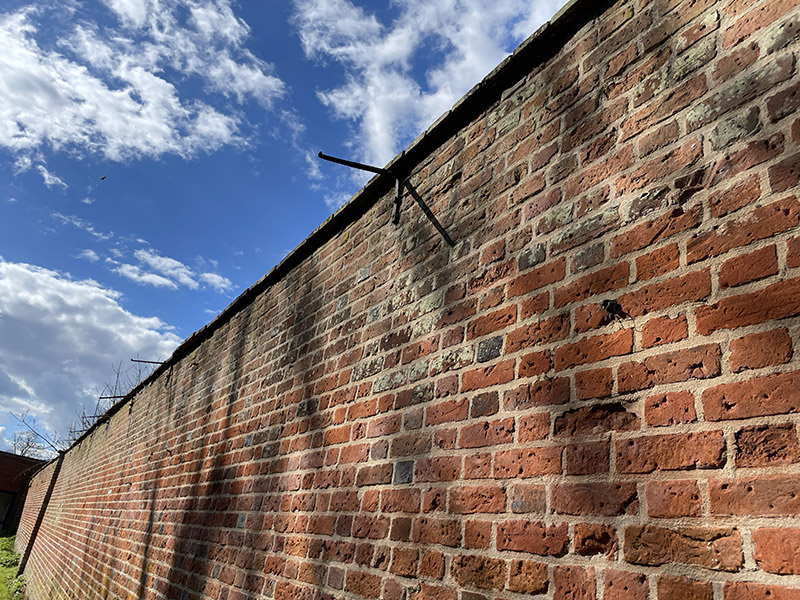
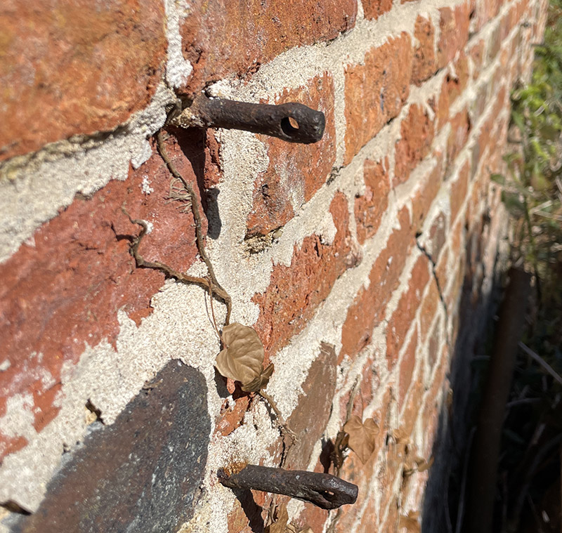
In 1764, before Jeffrey’s map, the Estate’s garden accounts show details of monthly wages for the gardeners and purchases for fruit trees and vegetables. Between 1772 and 1788, the garden accounts are illuminating and describe a busy productive garden. Purchases were made of numerous melon frames (86 in one order) and cucumber frames (24 and then 41 in different orders). Records also indicate a hothouse with frames and a stove that was connected to a cistern (which had to be soldered). Wool was bought to cover the fruit trees or bushes and cheese cloth to make bags, possibly to protect exposed soft fruits from bird and insect damage – there are a number of metal pegs for attaching coverings on the outer face of the west wall. Care was taken of the glasshouses – the glass was removed, the putty taken off and then the glass was replaced and re-puttied. Pots were washed, wasp nests destroyed and gloves bought for use when pruning the gooseberries.
From 1791 to 1804, the garden accounts record that among the usual bills for the carpenter, wheelwright, harness maker, mason and ironmonger, there was the glazier, a Mr Goodluck whose bill was always higher than anyone else’s account, even coal or coke. In 1801, when the entire garden sundries bills for the year were £82 10s 0d, the glaziers’ bill was £49 9s 5d! The continual cost of glazing from 1796 to 1830 is worth noting as glass tax was imposed from 1745 to 1845.
In the following years, the garden appears to increase in productivity with continuing purchases of trees, seeds and sundries to support the horticulture. The most expensive outlay was for the destruction of wasps nests, ice-carting and water pumping. The use of horses as a workforce in the garden continued until after WWI, although a lawn mower was purchased before 1914 and from thereon consistently needed repairing.
Between 1942 and 1946, the garden seemed to function as a market garden, selling a staggering amount of produce to local buyers. An account book has been kept of all produce sold (and to whom) showing that in July 1945, 245 dozen nectarines, 805 peaches, 1387 cabbages, 899lbs of tomatoes amongst other produce were sold. There are no more accounts after 1967 although it appears that the land was leased out to a commercial garden company but then unfortunately has been left to become derelict.
Site Description
Location, Area, Boundaries, Landform Settings
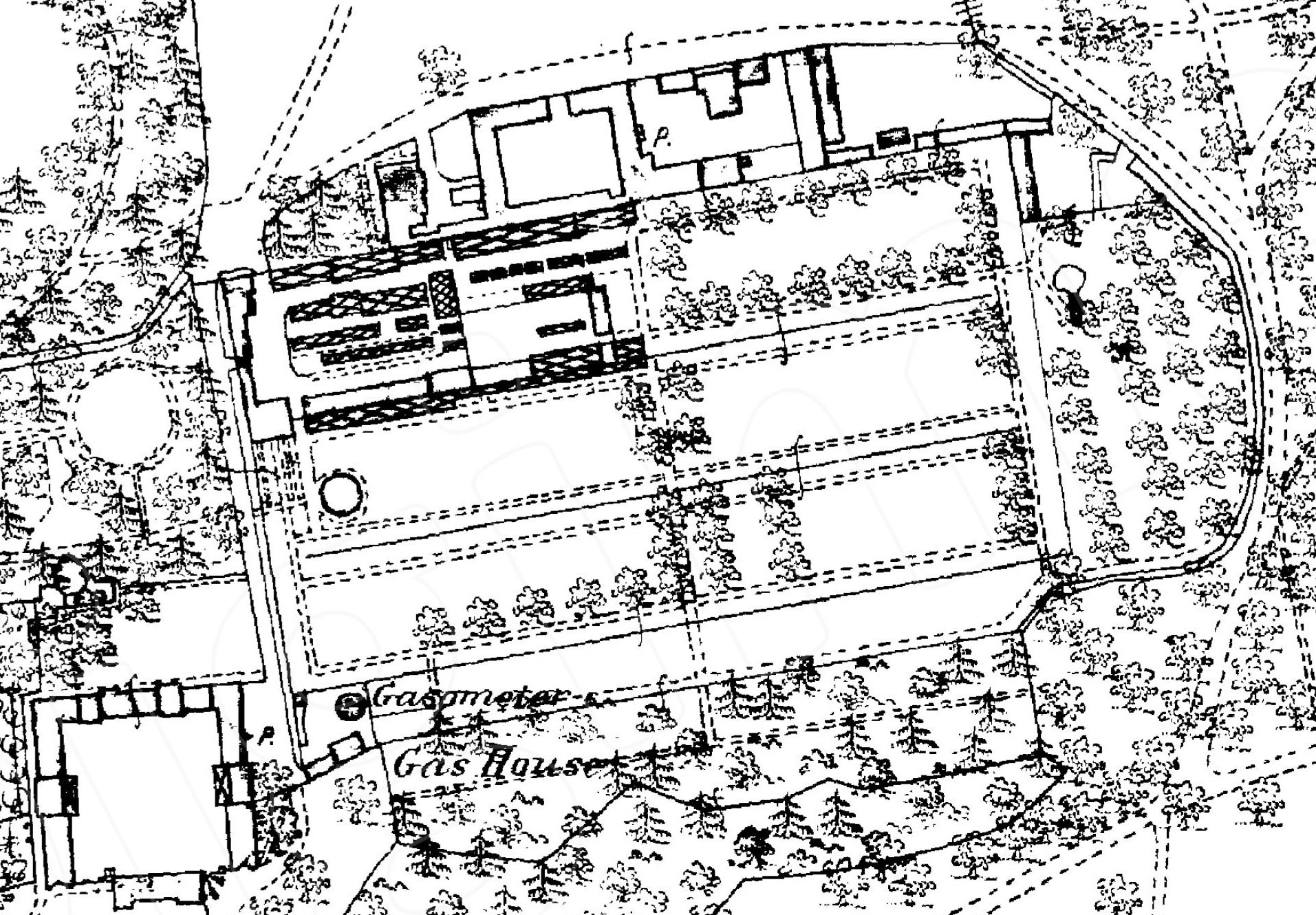
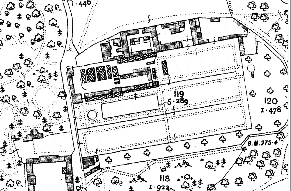
Many of the observations below are taken from early maps, mainly the Ordnance Survey (OS) maps from the 1st edn of 1875 onwards. Measurements cited are often taken from these maps and therefore approximate.
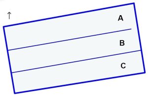
Diagram 1
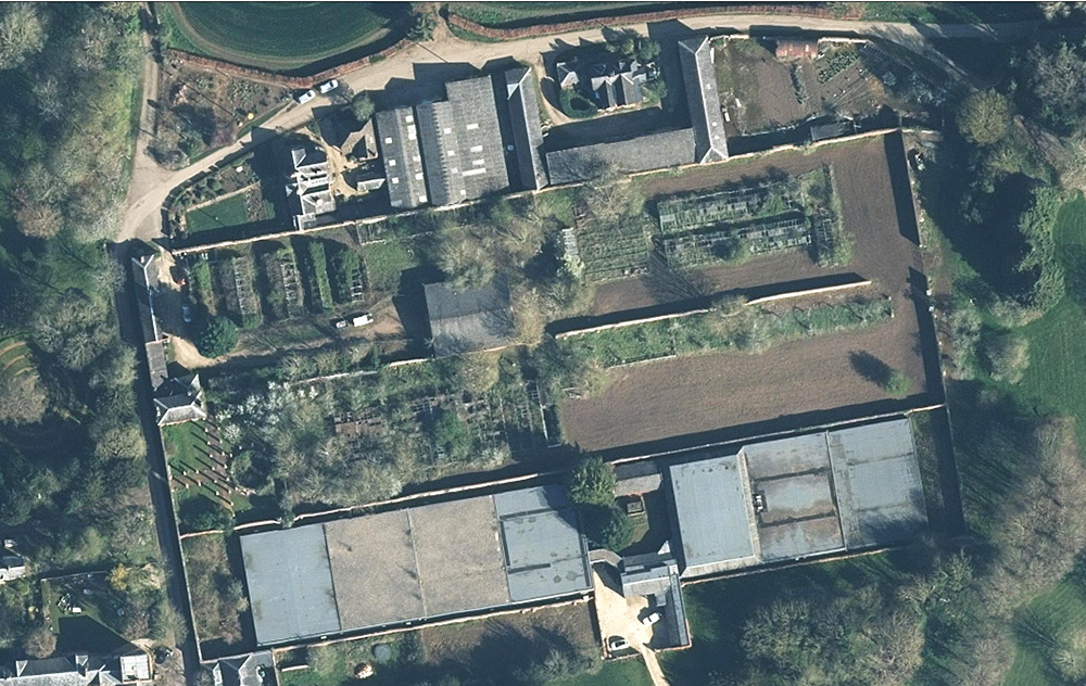
The walled kitchen garden lies within Nuneham Park, 250m north-east of the Global Retreat Centre at Nuneham House, and 105m east of All Saints Church. It is surrounded by brick walls some of which have been rebuilt or repaired over the years. Two internal brick walls run east to west to divide the garden into three roughly equal narrow rectangular sections. The three sections are referred to here as Areas A, B and C, with A at the north (see diagram 1). The overall dimensions of the three together are 176m x 94m. The area within the main walls is 1.6 ha (4 acres) including the Gardener’s House and Bothy House to the west.
Adjacent and immediately to the east was a small orchard (shown on OS maps of 1875, 1912 and 1933). To the south there was a slip, which became an orchard (shown on OS maps of 1912 and 1933). The height of most of the outer walls, excluding the north wall, is c. 3.0m – 3.5m (3.2m where measured) with brick copings in various forms. The north wall has several stone courses at the lower levels. Adjacent and to the north of the walled garden is Home Farm which originally comprised residential and storage facilities some of which were attached to the north wall. This group has recently been converted into holiday apartments.
The gardens appear to have had no immediate access to water although there is a lake at 80m to the east, a spring at 266m to the north-west, and the River Thames lies 550m away when measured directly to the west. Geologically, the walled garden lies on sandstone (Lower Greensand Group).
Buildings, features, facilities
Within the north-west corner of the walled garden and sharing the outer walls is Bothy Cottage which is currently occupied as two cottages. Attached to these to the south, within the walls of Areas A and B is the unoccupied Gardener’s House c. 1838. Its garden includes a circular pool and 30 square pillars, 2.6m high. These pillars originally formed a double row along the paths and a circle around the pool, visible on the 1875 OS map. The pillars are 0.35m square and are tagged for vegetation. Opposite the pool there is a decorative iron gate in the west wall (1.32m wide, 2.61m high).
The whole of Area C has been occupied since the late 20th century by a book repository belonging to the Bodleian Library. It now houses the Estate offices, with the entrance at the middle of the south wall. At the centre of Area A is a large modern storage unit or garage that stands adjacent to the wall between Areas A and B.
Entrances and approaches
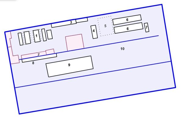
Diagram 2
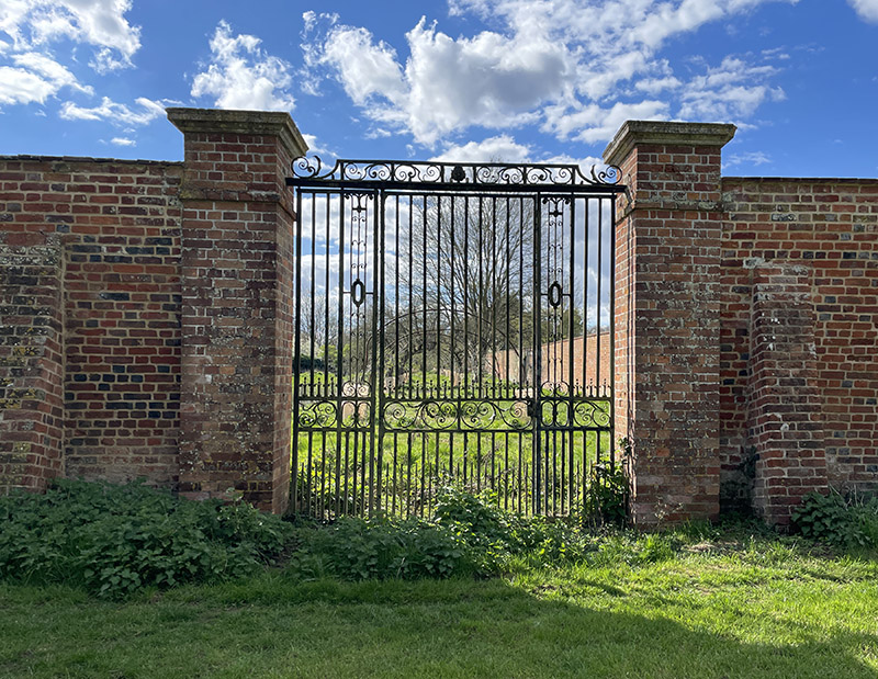
The main entrance was half-way along the east wall, opposite Area B. The single decorative forged iron gate (listed Grade II) is possibly 18th century and the brick piers were probably rebuilt in the late 19th or early 20th century. The opening is 2.9m wide, the gate c. 3m high, with gate piers and a buttress on either side. Another, wider entrance (6.25m wide) lies c. 4.0m to the north of the listed gate, closed only by a modern temporary construction fencing gate.
Other gates exist on the west wall including a gate to Gardener’s House and further north on the west wall is a closed gate with wooden door, perhaps leading to Bothy Cottage. On the north wall is a new or rebuilt arched single gateway towards the east end. At the north-west end of the garden, to the west of glasshouse [3] (see diagram 2) there are several other doors or windows visible in the north wall which probably lead to the early horticultural buildings. At the south-east corner is an original gateway (c. 2.3m x 1.1m) with an iron gate that now leads to a small area to the east of the library repository buildings. There is open access to the main gardens to the north of Bothy Cottage.
The 1875 OS map shows that the two east-west walls that divide the garden into three Areas are not continuous to the outer walls. Instead, there are footpaths around all three Areas and also running north to south in the middle. By 1912, the walls at the west had been joined to the outer wall but those at the east still allowed a pathway to run north to south. By 1973, the internal wall between Areas B and C had been extended to join the east wall, presumably related to the security of the book repository.
Glasshouses, buildings, frames & pergola
(labelled [1] to [10], see diagram 2)
Historic development of the glasshouses
On the Davies map (1797) there is a long thin structure stretching along the north wall from the west to one third of the way to the east. Although not very clear this may well have been a series of pits or a glasshouse. The accounts first mention a glasshouse in 1795 when 43 frames (for lights) were ordered for the ‘Hothouses’. In 1796 four squares of crown glass were ordered for repair to the stove. On the Brown map of 1798 there are clearly two buildings in the north west corner and Brown is said to have referred to the walled garden as the melon ground. (This does not necessarily mean for growing melons but having a heated ‘pit’ for growing tender crops). The consistent purchase of glass and the large numbers of frames for ‘lights’ ordered, both for inside glasshouses and out, indicates that the hothouses were well used.
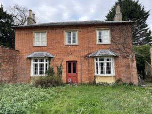
Gardener’s cottage
Regular orders of large quantities of coal appear in the accounts by 1807 and in 1837, £87 was spent on ‘installing hot water apparatus in the greenhouse’. In 1833 Claudius Loudon visited the estate and reported that “there had been extensive alterations to the kitchen garden but a good gardener’s house was left till last . . “. It is possible that this refurbishment included the erection of the glasshouses indicated on the tithe map (1838). These constituted two additional glasshouses and a selection of buildings all in the northern part of the garden, mostly orientated west to east and with a variety of identified uses. (It is possible these glasshouses were constructed by J. Weeks & Co, Chelsea. A very successful company specialising in glasshouse heating equipment between 1840s to 1908). On the 1st edn OS map of 1875 there were 14 glasshouses which had increased to 23 by the 2nd edn OS map, 1912. In 1893, an order for vine manure is recorded and a bill for mushroom spawn, which implies both the existence of a vinery and a mushroom room. The accounts name glass and timber bought for the vinery in 1901, glass bought for the peach house in 1913, paint for the vinery in 1924 and repairs to ‘the peach house and a carnation house’ in 1915.
A further refurbishment of the estate in 1903 included removing approximately 12 of the old greenhouses and replacing them with new ones re-orientated running north to south, reducing the total to 16. The old vinery, possibly one of the original glasshouses was advertised for sale in the Oxford Times on 1 December 1928. As vines were continually purchased from 1858 to 1916, there must have been another vinery. Additionally a new boiler had been purchased, as well as a large amount of wire with strainers, two hundredweight of putty(!), paint for the vinery, adjustment to the heating and, listed in the accounts, a “New Superstructure to (Old Pit) span house and greenhouse blinds”. Whereas between 1750 and 1850, glass was the most expensive annual item in the accounts, it was now coal and coke and in 1928 there is reference to a furnace door. Does this imply a central boiler that supplied heating to all the glasshouses?
Throughout the years, purchases of items to support the evidence of use and maintenance of the glasshouse was on hand. In 1843 there was a bill for Tobacco liquid for fumigating the glasshouses; in 1895, 1923, 1926 and 1928 sash cords were purchased; between 1925 and 1927 a large number of blinds were bought for the greenhouses and from 1924 to 1928 shading was ordered, between April and July. The majority of the glasshouses have heating pipes and the accounts record that large bills for glasshouse heating equipment were purchased up to 1965.
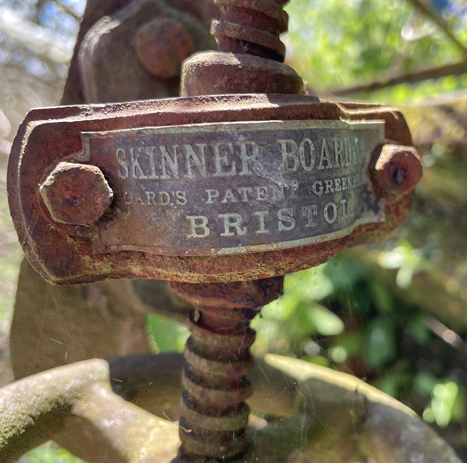
One of the later glasshouses to be erected was a curvilinear house (see below Glasshouse [8] and diagram 2) and may be associated to a bill, in 1908, to Oxford Cement Co., for 4 tons of cement ‘for the new glass house’. These glasshouses were designed by the Bristol firm of Skinner & Board, who were producing glasshouses from 1884 to the 1970s. Possibly the last houses to be erected are those marked 6 and 7 on diagram 2 (see description below).
Area A – Glasshouses, bothies and beds
[1] — Glasshouses
Five clear span glasshouses orientated north to south. They are of various sizes and erected for differing purposes. They appear to have been built by the same company, having similar construction and internal features. All have cast-iron spandrel brackets. From the north-west:
- (a) brick built frame, length c. 20m.
- (b) brick built frame, length c. 20m, with cold/hot frames to west and east sides.
- (c) brick built frame, tallest glasshouse, with cold/hot frames to west and east sides, c. 20m x 5m.
(d) brick built frame, length c. 20m, internal 1m high brick enclosing beds.
(e) smallest glasshouse, c. 14.5m x 4.5m set back by 2 metres to the north.
[2] — Buildings
Four small units built against the north side of the northern internal wall. The units would most likely to have been potting sheds and storage facilities. From north west:
- (a) The largest unit with a plain door and a windowed door. This could have been the gardener’s bothy and contains evidence of coat and tool hooks, on which there remain three ‘dibbers’.
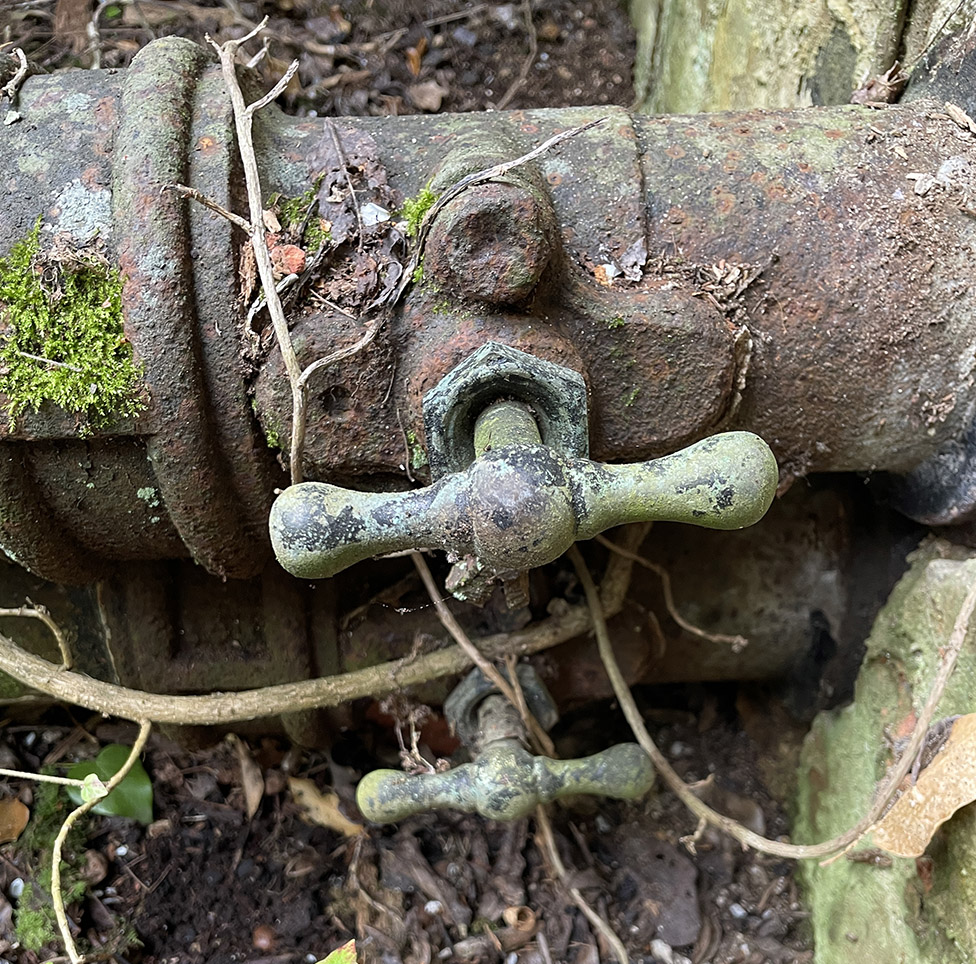
- (b) A large unit c. 12m x 4m with a door and a window, and with thick slate shelvings at waist height and above. Heavy pipework with taps.
(c) A small plain unit c. 4m x 3m with angled roof.
(d) Similar to (c).
[3] — Glasshouses
According to the 1875 and 1912 OS maps, there were originally three additional joining glasshouses to the west, against the south-facing wall and to the north of [1].
These seem to have been removed when those at [1] were re-orientated. So, there were originally five east-to-west orientated glasshouses here of which the two easterly ones survive. Between the two groups was a doorway to Area A.
The current two components of [3] comprise wooden verticals and iron horizontals, with bases of brick. The west component had rear walls that were whitened on plaster. Together these two glasshouses (length c. 40m) extend the length of the highest part of the north wall viz where it has been rebuilt to support them.
[4] — Glasshouse
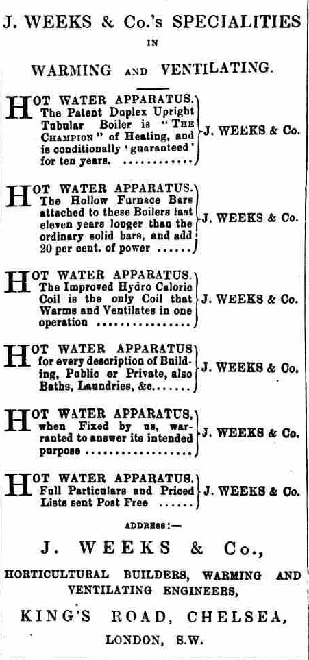
Advertisement for J Weeks & Co in ‘The Berkshire Chronicle’, July 1, 1882.
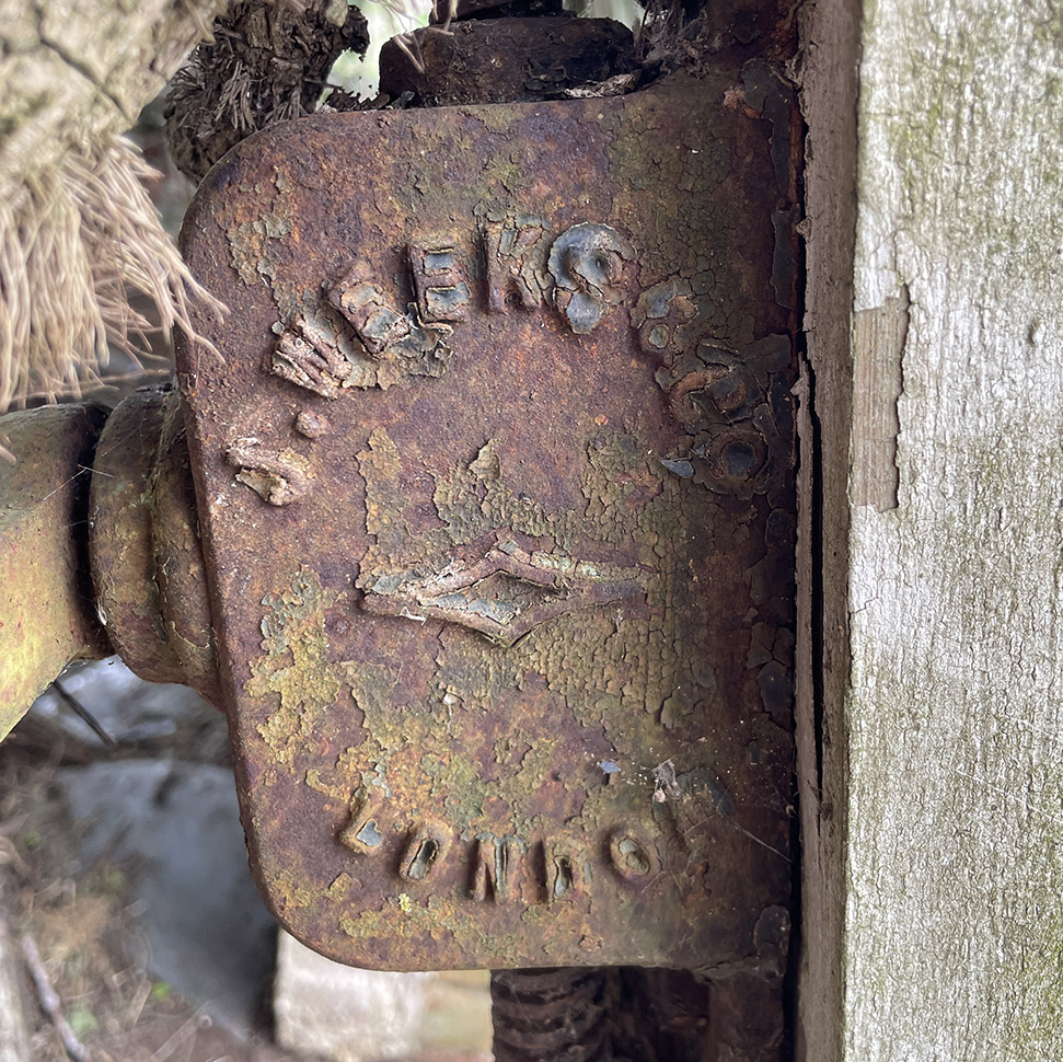
Across the centre of Area A is a low clear span glasshouse orientated north to south, c.16m x 4.5m. The ground at the south end is lower than the surrounding ground where there is a brick built sunken area. There is a door at both ends. Ironwork is labelled “J. WEEKS & Co, LONDON”. There are two internal brick based square beds suggestive of particular planting. The cast-iron spandrel brackets are the same as [1].
[5] — Beds/Frames
To the east of [4] and stretching close to [6] are six substantial concrete edged frame or bed-like structures orientated east to west, less than half a metre high, forming beds about 10m long. They could have had removable coverings with frames or mats.
[6] — Glasshouses
- (a) a single-span glasshouse, length c. 32m, with a single iron plate door.
- (b) a double-span roofed glasshouse, having two iron plate doors, and appears to be formed of two partially joined glasshouses.
Both are orientated east to west and are constructed with metal struts. The single-span to the north is taller. Both contain large diameter iron pipes and each has a standing water pipe. These may have been the most recent additions to the garden.
[7] — Glasshouse
A short glasshouse, orientated north to south, double-span, c. 10m x 4.5m. The lower side walls are concrete. There are two water tanks sunk into the floor at the north end shared with glasshouses [6].
Area B Central ‘Nursery’ & glasshouses
(The 1973 and later maps refer to this central Area as the ‘Nursery’.)
[8] — Glasshouses
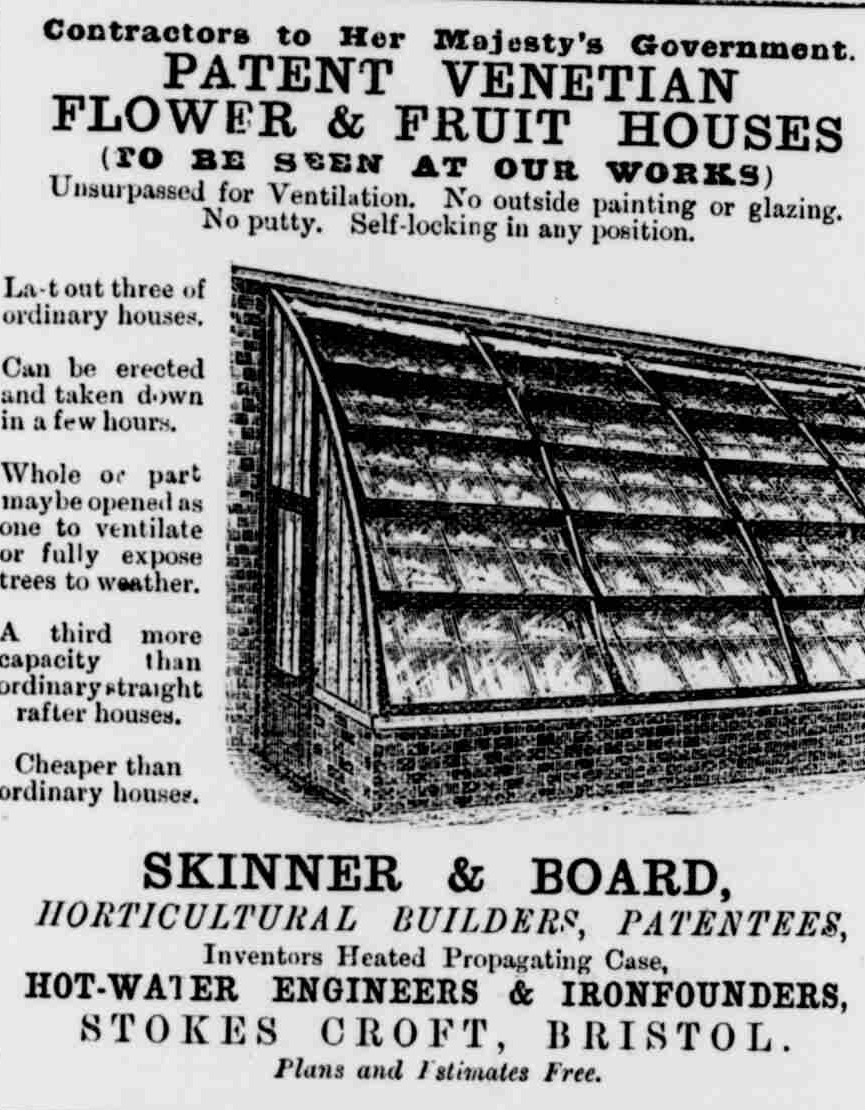
Advertisement in ‘The Bath Society Paper’, January 11, 1893.
- (a) At the west end, against the south-facing dividing wall between A and B is a lean-to glasshouse.
- (b) Near the garden entrance at the west is a three-quarter span glasshouse. The roof and main side structures are timber and there is wood cladding over the brick base rows. Together (a) and (b) measure c. 40m.
- (c) Joining glasshouse (b) via a door in a dividing wall is a taller three-quarter span glasshouse with iron uprights and cross-wires, made by Skinner & Board, Bristol, as identified by their name on the gearing ventilation system for opening the side and top windows. Whitened plastered rear wall.
[9] — Soft fruit area
At the centre west area are steel and wooden plant supports, 2m high, measuring c. 50m x c. 14.5m, probably for fruit bushes. There is evidence of glass roofing and iron netting. At the east end are the remains of wooden sheds or similar, perhaps packing sheds. Near this east end is a fan suspended from the ironwork stakes.
[10]— Pergola and uncultivated area
Along the internal north wall towards the east are curved hooped iron supports for a pergola or tunnel for fruit trees, including apples of which some remain. At the east end there are young trees that seem to have been planted more recently in the 20th century. The supports are c. 3m high in iron or wood. Otherwise, this area is now grassed over, notably to the south. The listed gate on the east wall is visible in the distance.
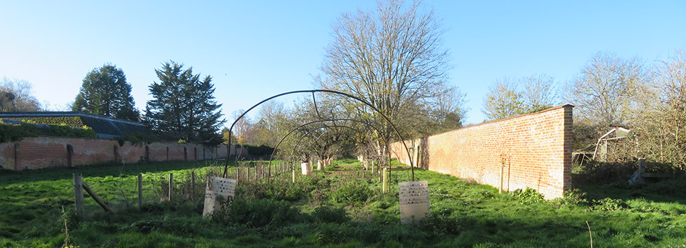
View of fruit pergolas from the west. © Vanessa Fell
Current Use: Derelict
Ownership and Access: The Nuneham Estate – no public right of access to the walled kitchen garden.
Designation Status:
The landscape garden and parkland of Nuneham Courtenay lie within the Historic England Register of Historic Parks and Gardens at Grade I: https://www.heritagegateway.org.uk/Gateway/Results_Single.aspx?uid=2130322&resourceID=858
The main gate in the east wall of the walled kitchen garden is listed at Grade II:
https://www.heritagegateway.org.uk/Gateway/Results_Single.aspx?uid=1368718&resourceID=5
Name of District: South Oxfordshire DC
Grid Reference: SU 5436 9826
Sources of Information:
Airs, M., & Tyack, G. Nuneham Courtenay: the house, the landscape and the village. Parchments Print of Oxford. n.d.
Campbell, S. (1998) Walled Kitchen Gardens. Shire Publications, Botley, Oxford.
Harcourt estate and family papers, late 12th cent.-1967, Bodleian Libraries, Bodleian Special Collection MS D.D. Harcourt
Nuneham Courtenay garden accounts, 1764-89 (c. 140); 1842-7 (b. 91); 1851-61 (a. 5)
Nuneham garden labour accounts, 1847-60 (d. 102)
Nuneham estate garden accounts, 1827-9 (c. 560); 1847-50 (c. 561);
Nuneham Park accounts for estate, repairs, woods, garden, game and charity and subscription payments, 1892-6 (c. 375) ; 1897-1901 (c. 376); 1902-1906 (c. 377); 1907-1909 (c. 378); 1910-13 (c. 379); 1914-17 (c. 380); 1918-1922 (c. 381); 1923-1927 (c. 382); 1928-1933 (c. 383); 1939-1942 (c. 385); 1954-67 (c. 386). Nuneham kitchen garden, record of fruit and vegetables sold, 1942-7 (c. 434)
Nuneham kitchen garden receipts and accounts 1942-1948 (c. 435)
Jameson, R., Victorian and Edwardian Glasshouses: History and Conservation, The Building Conservation Directory (2013), pp. 183-142, published by Cathedral Communications Ltd.
https://www.buildingconservation.com/articles/glasshouse-conservation/glasshouse-conservation.htm
The History of the Nuneham Estate??????
Maps
Davies, Richard, cartographer A new map of the County of Oxford: sheet number XI, 1793-94 Oxford History Centre, Heritage Search, Picture Oxon MP:1175.11
https://heritagesearch.oxfordshire.gov.uk/images/POX0250911 (accessed 8 May 2026)
Jeffreys, Thomas, engraver to His Majesty MDCCLXVIII, 1766-67. The County of Oxford, Surveyed Anno MDCCLXVI and VII Oxford History Centre, Heritage Search, Picture Oxon MP:1174
https://heritagesearch.oxfordshire.gov.uk/images/POX0250888 (accessed 8 May 2026).
Nuneham Courtenay, Tithe Map, 1836, Oxford History Centre
https://www.oxfordshirehistory.org.uk/public/maps/tithe/zoomified/zoom.htm?Nuneham-Courtenay (accessed 8 May 2026).
Ordnance Survey (1875, 1912, 1933, 1973, 2025): County Sheet Series, tile SU5498, 1:2500, Digimap [Online]. Available at http://edina.ac.uk/digimap (accessed 25 April 2026).
Plan of Alterations, Capability Brown, 1778-9 in The Nuneham Estate Parkland Management Plan. (Plan D) Askew Nelson Ltd., 2019.
https://culhamstorage.co.uk/assets/documents/cd6.2.1-nuneham-a3-volume-ii-may-2019-final-_compressed_2_.pdf (accessed 8 May 2026)
Images
The advertisement for J, Weeks & Co and Skinner and Boardman are posted with the permission of The British Library Board, all rights reserved (www.britishnewspaperarchive.co.uk).
Vanessa Fell, Felix Lam, May 2026